Northumberland, the genesis of the Shellaker family – An Unproven Theory
I have a theory, one admittedly which could be torn apart if the settlement called Shellacres, in the very extreme north of our country, is actually named, for example, after a Victorian farmer who owned the land. However I will put forward my fledgling theory, together with the circumstantial evidence which could arguably support it.
WHERE IS THE PLACE NAMED ‘SHELLACRES’
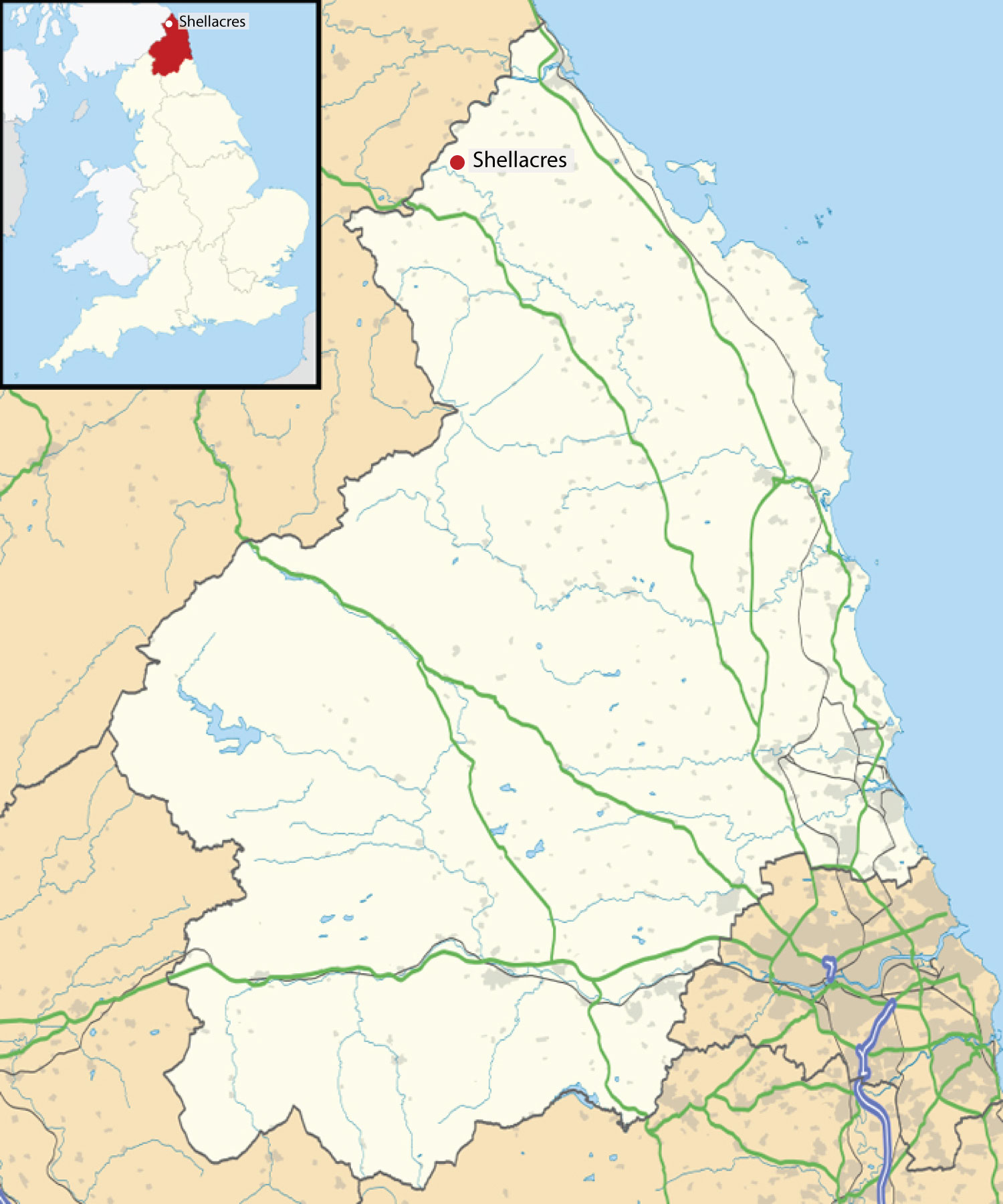 Shellacres is located in Northumberland, the northernmost county of England. Northumberland shares a border with Cumbria to the west, County Durham to the south and with Scotland to the north. The place known as Shellacres is extremely close to the current border between England and Scotland.
The Anglo-Saxon Kingdom of Northumbria
Northumberland was more anciently known as `Northumbria‘ and was one of the largest and most powerful kingdoms of Anglo-Saxon England. Its territory extended from the River Humber to the Firth of Forth – hence the name ‘the land north of the Humber’. Although powerful, it suffered constant invasion from the Danes and from the Scots.
As the history of this area plays a part in my unproven theory I will attempt an extremely brief précis of the history of this region.
After the Romans
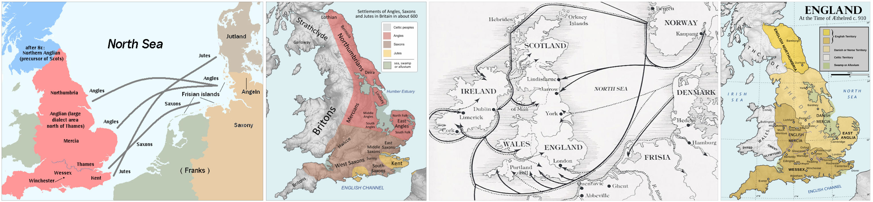
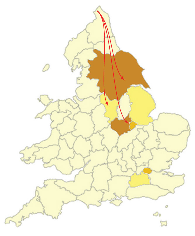
The Romans invaded Britain in 43AD and stayed until 410AD when most of the Roman troops left to defend Rome against the Visigoths. From this point in our history, Britain was not longer part of the Roman empire and was virtually defenceless against foreign invaders. Most of these first invaders were numerous Germanic tribes the most dominant of which were the ‘Saxons‘ however it was another Germanic tribe, the ‘Angles‘ after whom our country was eventually named. Other tribes who came over around this time were the ‘Jutes‘, who settled mainly along the south coast and the ‘Franks’ who reportedly settled in Kent. The map, below left, shows the routes taken by these invaders in the 5th Century.
The invasion of these Germanic peoples, resulted in the establishment of ‘Anglo-Saxons’ kingdoms across most of what is now England also in parts of lowland Scotland – the map centre left, shows the approximate areas of these kingdoms.
A Turbulent Area – The Arrival of the Norsemen
On June 8th in the year 793 AD, marked a important date in the Anglo-Saxon dominance of the country. This was the day the Norseman first attacked these islands, (it was not until Victorian time these invaders become known as ‘Vikings’). Their first attack was at Lindisfarne off the Northumbria’s eastern coast. Lindisfarne is around 20 miles away from the current settlement of Shelacres. The invaders who came to Northumbria were predominately from Norway but they also came from Sweden and Denmark – the map, centre right, shows the routes they took.
Over the succeeding decades, the Norsemen made ever deeper incursions into England and finally in 876 AD, the Anglo-Saxon Chronicle records that their leaders ‘shared out the lands of the Northumbrians’. Although the Norse populations of Scandinavia initially travelled to Britain to slaughter and pillage, over the subsequent decades they established to trade links and then settled into many parts of Anglo-Saxon England including the Kingdom of Northumbria.
The Norsemen were to control the north of England until the 10th century when the wave of recovery by native rulers, which began with the victories of King Alfred in Wessex, swept into Northumbria. At this time Northumbria became an earldom sitting uncomfortably between the English realms to the south and the Scottish kingdom to the north. Map above far right. These map can be enlarged by clicking on one of the four maps.
A Turbulent Area – A Battle Ground
In later centuries many great battles have been fought on Northumbrian soil between the English and the Scots. Until the Union of the English and Scottish Crowns in 1603 life in the Border County could be extremely dangerous and was often a one of strife and misery.
‘SHELLACRES’ ON THE MAP
 The modern settlement of Shellacres consists of a farm buildings and only one or two houses. It is situated on a ‘B’ road, off the A698 and is in the civil parish of Cornhill-on-tweed.
The nearest town to Shellacres is the Scottish town of Coldstream, which just over a miles away and is on the far side of the River Tweed which forms part of the current border between England and Scotland.
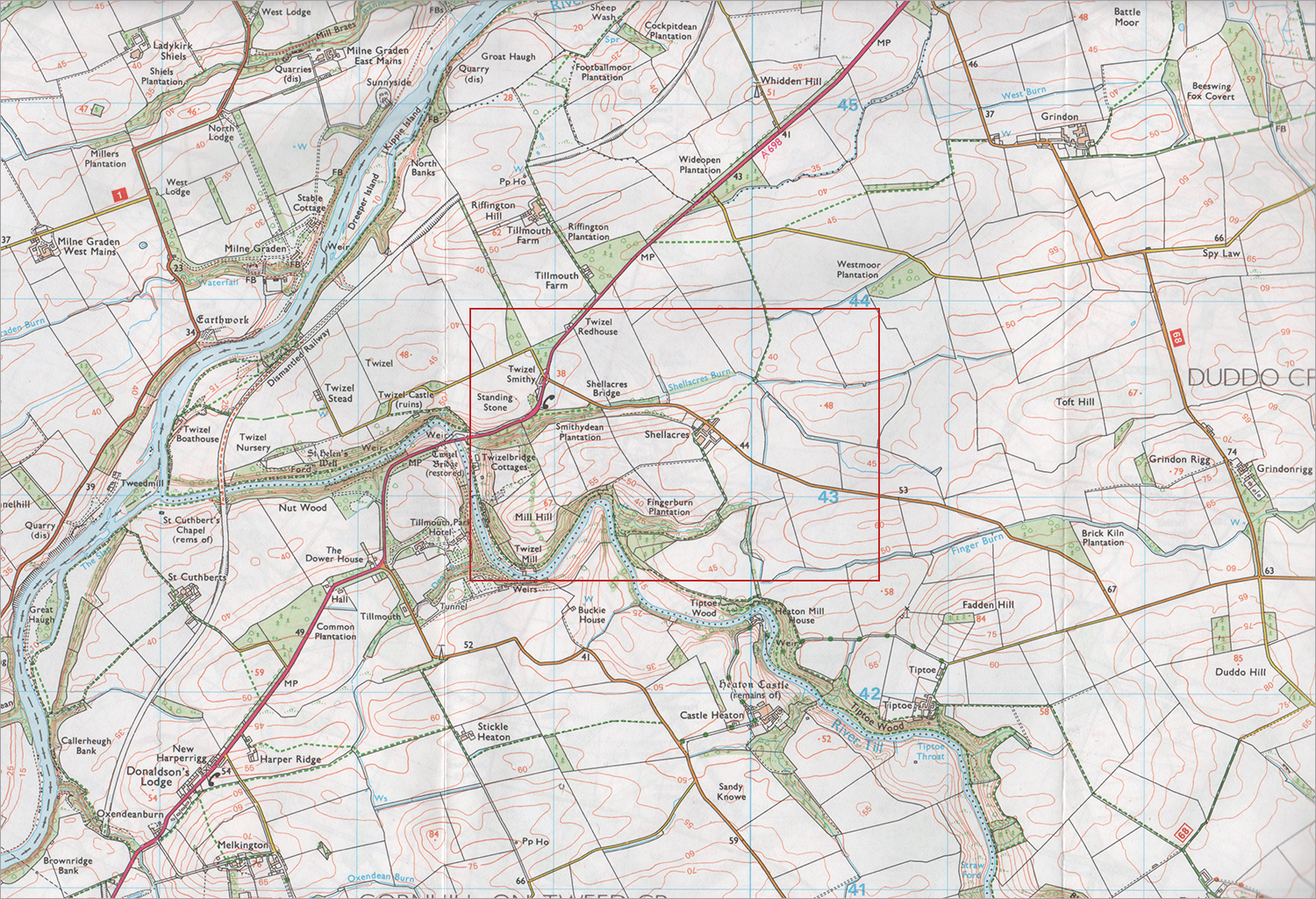
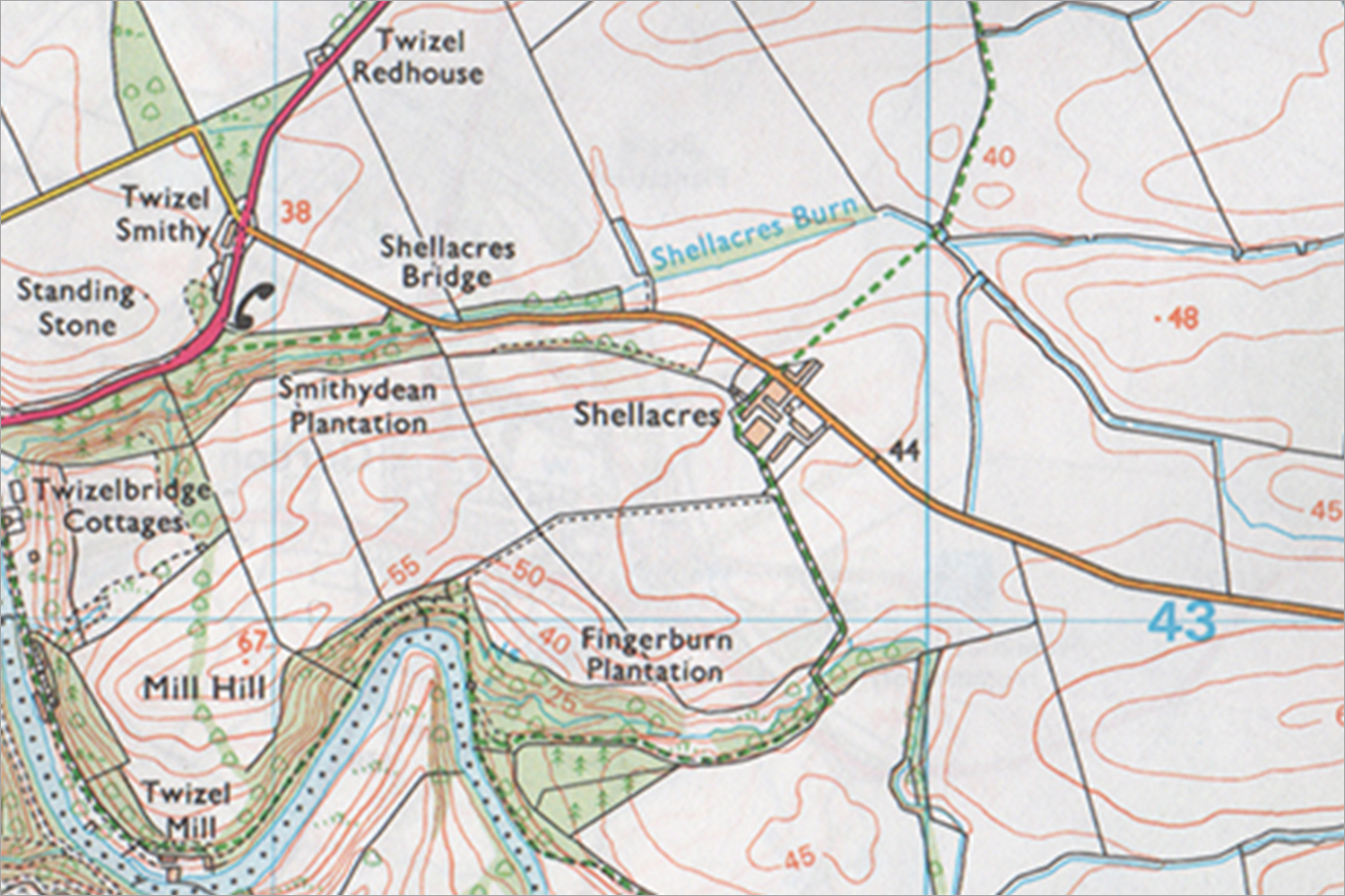
The settlement of Shellacres can be seen on Ordnance Survey map 339 – ‘Kelso, Coldstream & Lower Tweed Valley‘ – a section of which is shown on the right.
On this section of the map the River Tweed can be seen on the left side of the section, the area to the left of this river is Scotland, the area to the right of the river is England. This map can be seen in more detail by clicking upon it.
The area outlined in red block the area in which Shellacres is situated, a larger version of which can be seen below.
Contains Ordnance Survey data © Crown copyright and database right. Licensed under CC BY-SA 3.0 via Wikimedia Commons
Shellacres – a Settlement, a Bridge and a Burn
As you can see on the enlarged section below the modern settlement of Shellacres consists of just a few buildings but interestingly there is also a stream with that same name, ‘Shellacres Burn’ – a ‘burn’ is a word for a watercourse, used in Scotland and England, especially North East England. A burn can vary in size from a large stream to a small river. The word ‘burn’ derive from the Saxon word “brunna”. A small distance west of the settlement of Shellacres is ‘Shellacres Bridge’ under which Shellacres Burn flows, joining the River Till, which is the only tributary of the River Tweed which flows wholly in England.
So what significance, if any, can we attach to the fact that not only a settlement has the name ‘Shellacres’ but also a bridge and a stream? Could I speculate that these features are long-established elements of the local landscape and suggests that the ‘Shellacres’ name stretches far longer into the past that the Victorian era?
Contains Ordnance Survey data © Crown copyright and database right. Licensed under CC BY-SA 3.0 via Wikimedia Commons
A VISIT TO SHELLACRES
In September 2012 during a short break in Northumberland I visited the place known as ‘Shellacres’. Below are a few photographs I took of the current buildings, the bridge and the burn. (Clicking on each set of photographs will enable you to see larger versions).
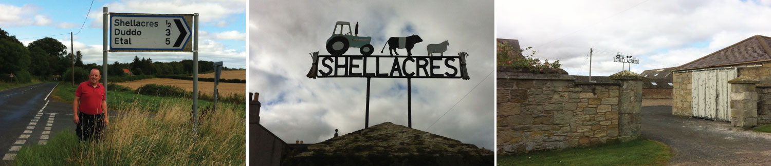
The junction of the A698 heading towards Shellacres – The Farm Sign – Shellacres Farm
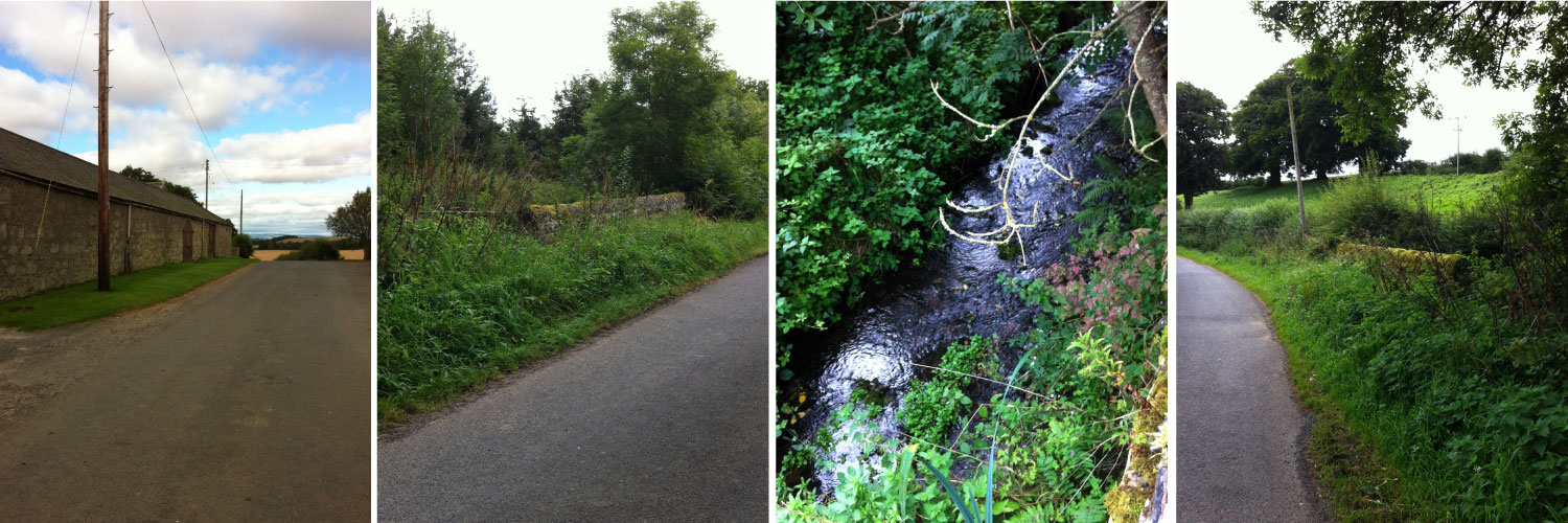
The farm buildings of Shellacres Farm looking east – The Wall of the North Side of Shellacres Bridge – Shellacres Burn – The South Wall of Shellacres Bridge
A DESERTED MEDIEVAL VILLAGE?
In my research to discover more about the local area I explored the possibility that the current settlement of ‘Shellacres’ may have been the remnants of a deserted medieval village (known as DMV) but although there are several DMV in the area ‘Shellacres’ was not listed amongst them. On a modern Google map below of the area around Shellacres I show DMV’s and other areas of archaeology. Shellacres is located on the right of this section with Shellacres Burn running north of the settlement towards Shellacres Bridge in the central top section of this map.
Two DMV’s in the area have been identified; one is ‘Tilmouth‘ located where Shellacres Burn mets the River Till and second is ‘Twizel‘ in the centre of the map. These DMV’s are classified as ‘medieval’ which is a period in history from around 476 AD to around 1500 AD. (The first date represents the fall of the Western Roman Empire but apparently the end of the medieval period is debatable – some say it was the Discovery of America (1492), others count the date as being the Beginning of the Reformation (1517).
Initially I was disappointed to discover that Shellacres was not listed as a deserted medieval village as that would be prove the settlement was in existence in the medieval period which would help to support my theory but on reflection it could not be classified as ‘deserted’ as the settlement is not deserted – it has been occupied for at least 200 years. The fact that Shellacres is not a DMV does not disprove it is a modern settlement, it may well have been a settlement for centuries.
Click on the map to view a larger version of the map.
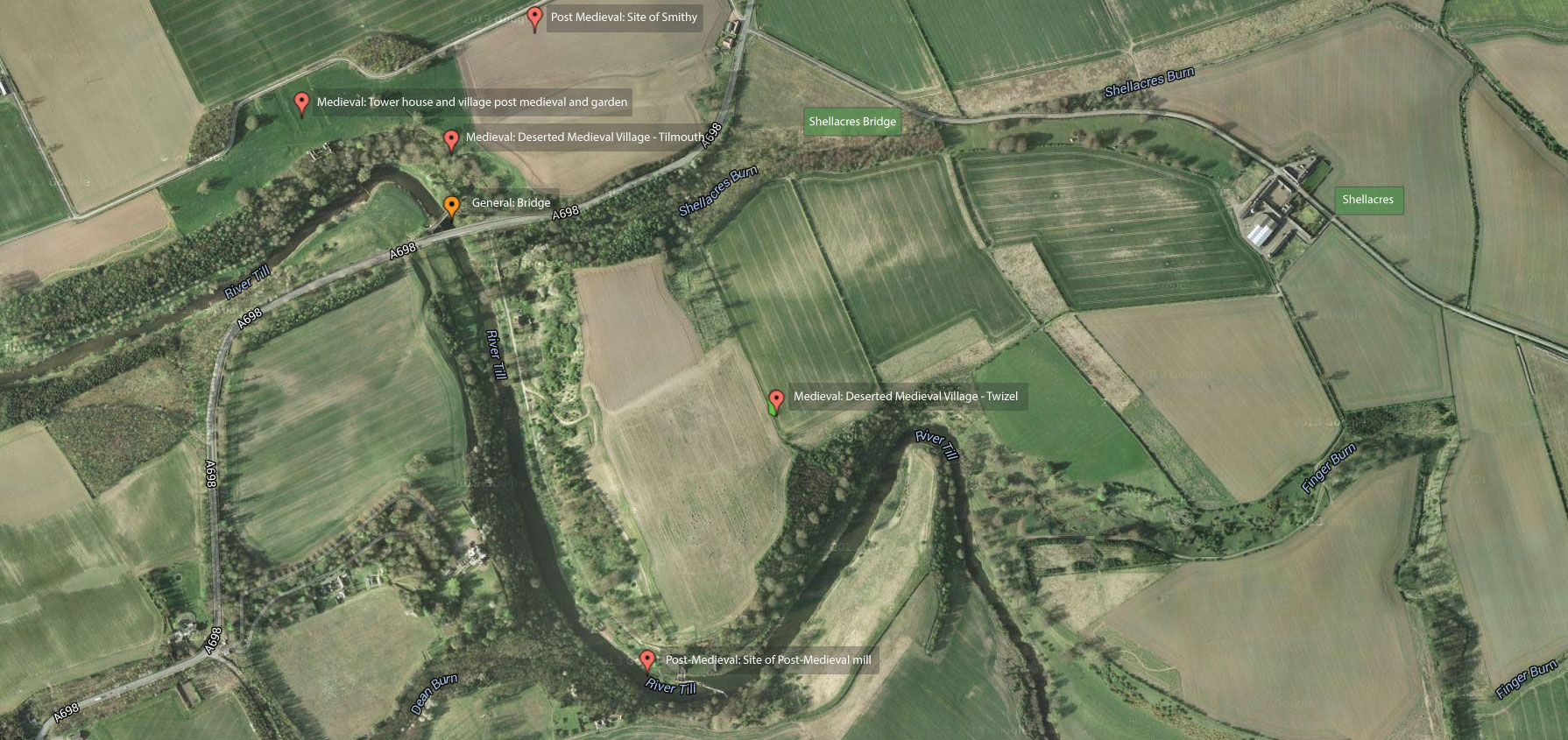
Modern Google Map of the area around Shellacres in Northumberland showing DMV’s and the locations of other archaeology
As I mentioned earlier this theory is pure speculation and in some elements, it is deliberate fiction to help set the scene……
 At a time during the Post-Romano Anglo-Saxon era a man or leader of a tribe made his home on an area of land to the east of the River Tweed in the Kingdom of Northumbria and began to farm the land.
Plausible??
Next Page: Conclusions